
Willis Woods
A "Vision for Willis Woods"
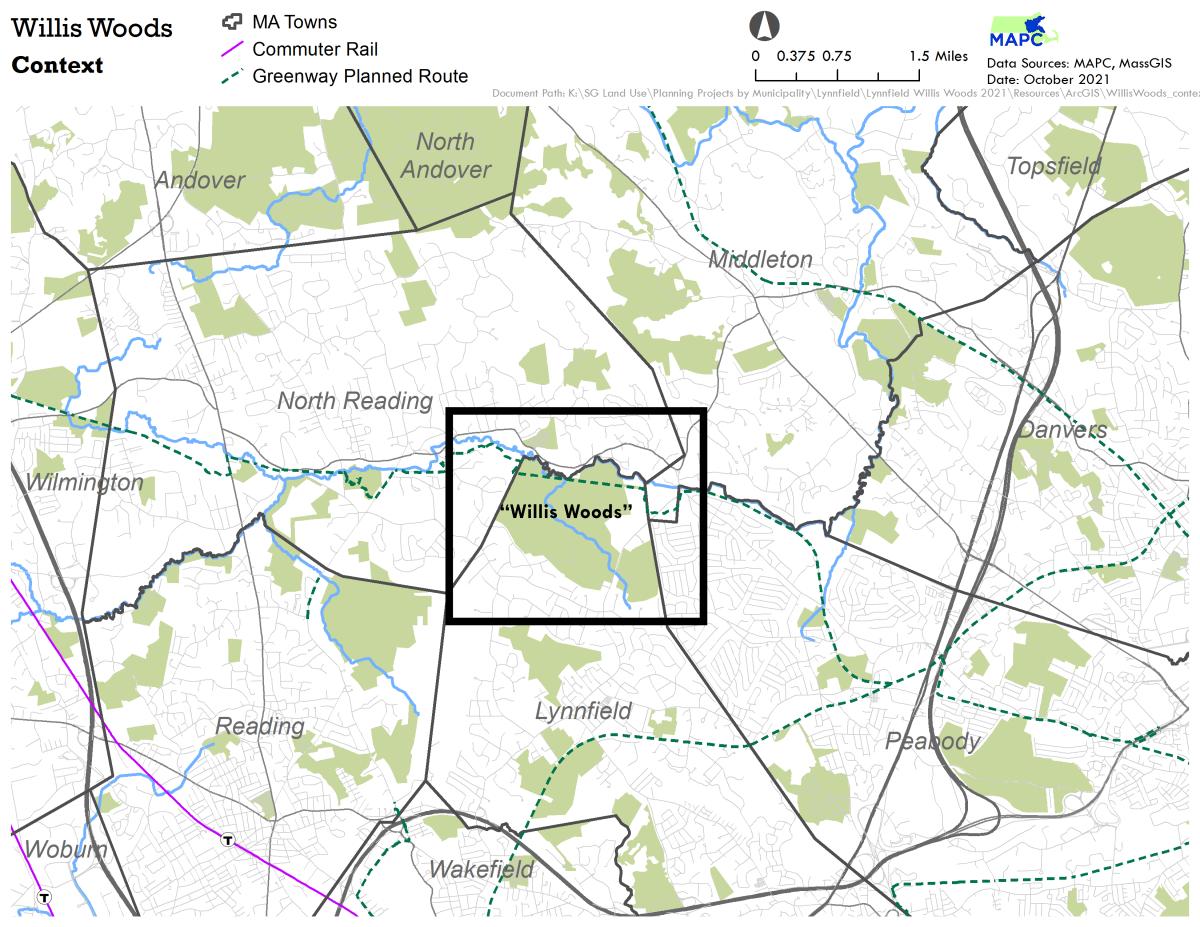
A "Vision for Willis Woods" is a collaborative effort to plan for the protection of a large area of open space along the Ipswich River at the intersection of the communities of Lynnfield, Middleton, North Reading, and Peabody. Some of the area is already permanently protected but closed to the public, and other parcels are unprotected and privately owned. Preservation of this undeveloped acreage holds the rare opportunity for a large, connected, wooded trail network as well as access to the Ipswich River.
Background on the Project
Bolstered by the July 2021 award of an MAPC (Metropolitan Area Planning Council) Technical Assistance grant, the Willis Woods project will create a vision, and ultimately a work plan, for hundreds of acres of open space at the intersection of the four communities of Lynnfield, Peabody, North Reading and Middleton, in order to protect drinking water resources, provide passive recreation connectivity, and maintain this aggregate area as open space in perpetuity.
This aggregate area is comprised of various conservation-owned properties, municipal water district lands, watershed lands and two miles of the former Salem-Lowell Rail Line, which is already cleared of railroad structures and is flat and walkable. This regional resource has the potential to connect to Peabody’s East West Independence Greenway. North Reading has a rail trail feasibility study currently underway. Middleton is seeking enhanced pedestrian access to the area along Boston Street. Bostik, Inc. is now working on a project to remove a dam on the Lynnfield Middleton line. A possible outcome of this project could result in both water access and recreational trail parking access once the dam is completely removed. In addition, MAPC, Greenbelt, Ipswich River Watershed Association, and other critical regional stakeholders have long expressed interest in preservation of this area.
Opportunities - and Maps that Show Them
This webpage includes important maps to show who owns the land, how the protection of Willis Woods would protect water supply and other natural resources of the area, and the potential for trail network opportunities for passive recreation.
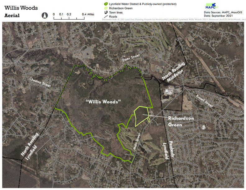
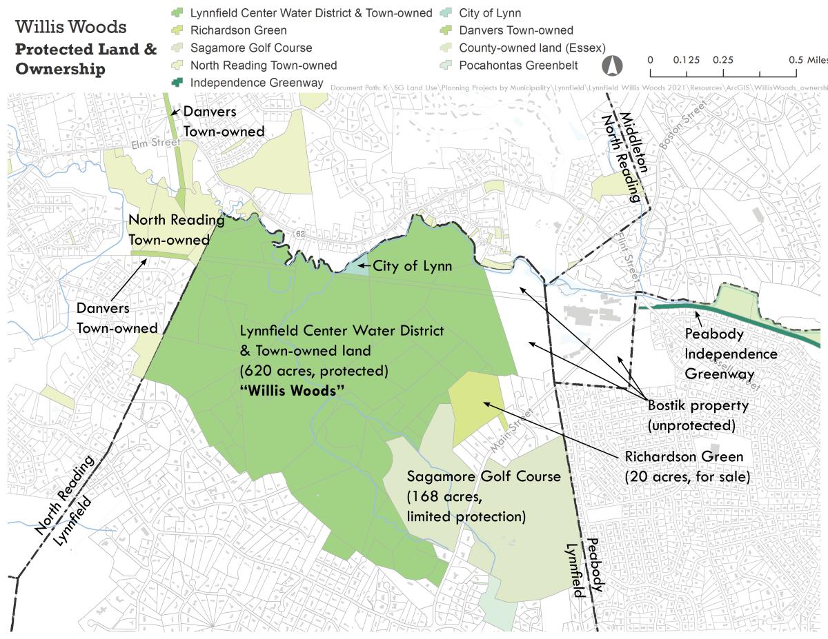
Who owns the Willis Woods land today - and MAP
Some of the area is owned by the Lynnfield Center Water District, some is owned by other towns in Essex County but not yet permanently protected, and other areas are unprotected privately-owned land. In particular, Richardson Green, a 20-acre parcel off of Main Street in Lynnfield is vulnerable to development. There have been several development proposals for the parcel recently, but the Town of Lynnfield was just awarded $1.6 million to assist in the acquisition of the land. Protecting Richardson Green would help add a key piece of the landscape, as well as potential access to the over 500 acres of undeveloped land.
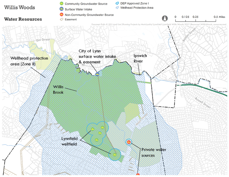
How can Willis Woods protect the water supply - and MAP
The map below shows the water resources in the area, including surface water intake, public wellfields, and private water sources. The Lynnfield Center Water District owns most of the area and is committed to the protection of the Town’s water supply.
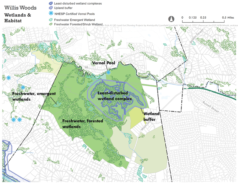
How can Willis Woods protect other natural resources - and MAP
Protecting the habitat and wetlands in the area, as well as Lynnfield’s high-quality water supply is of critical importance. The map below identifies the key natural features in the area, including vernal pools, undisturbed wetland complex and upland buffer, and a series of forested wetlands. Currently, unpermitted ATV (all-terrain vehicle) use of informal trails in this area threatens the health of these natural resources. Thoughtfully designing a trail system and allowing for low-impact walking and biking will provide public access to this beautiful land and help reduce illegal, higher-impact ATV use.
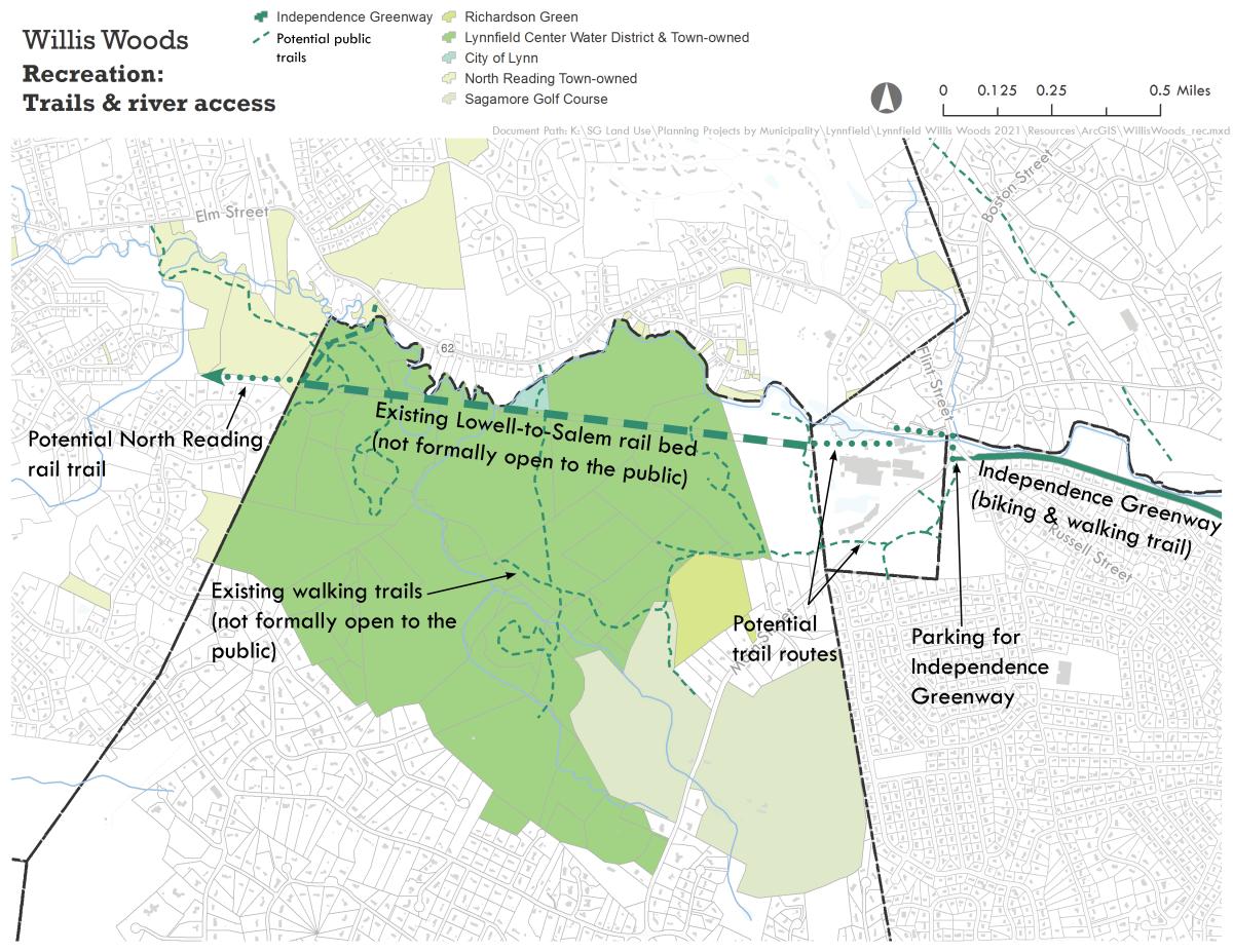
How can Willis Woods provide passive recreation opportunities - and MAP
There are over 500 acres of undeveloped, forest land owned and managed by the Lynnfield Center Water District. Although there are existing informal trails, this area has been closed to the public. A new approach to thoughtful resource management may create an opportunity to open this land for low-impact recreation.
In addition, creating trails in Willis Woods could help extend existing and planned trail connections. On the eastern end of Willis Woods, the Independence Greenway extends from the intersection of Russell Street and Main Street at the western tip of Peabody to West Peabody. The City of Peabody was recently awarded a State grant to build a pedestrian and bicycle bridge over U.S. Route 1 to connect this western segment of the Greenway to the eastern segment which nearly reaches downtown Peabody, as well as to connect the Greenway to the Border to Boston Trail, a 70-mille trail that connects the New Hampshire border to Boston. On the western end of Willis Woods, there is potential to connect to a proposed rail trail in North Reading.
Additional Information below here:
August 11, 2021 “Lynnfield lays out a Vision for Willis Woods” article
Fall 2021 - article - "Woods, Will, and Way" 01940 The Magazine, Essex Media Group
November 18, 2021 Community Forum - Power Point presentation
November 18, 2021 Community Forum - VIMEO Production
December 30, 2021 A Vision for Willis Woods - Final Report (Phase I)
A Brief History of Willis Woods