
Trail Map is published for Lynnfield’s Pine Hill Conservation Area
A trail map brochure is now available for visitors to Lynnfield’s Pine Hill Conservation Area - one of five Conservation areas in town. This is the third trail map to be published, following the first trail map for Bow Ridge Conservation area/Kallenberg Quarry, and the second for Patridge Island Conservation Area.
Produced by staff GIS expert Patrick McDonald, the brochure provides recreational trail mapping in addition to information about points of interest, historical significance and accessibility. The brochure is available at the Lynnfield Public Library and in the information rack outside of the Planning & Conservation office at Town Hall. It can also be downloaded below.
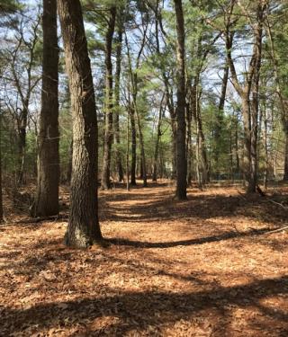
Pine Hill Conservation Area is a 9.5 acre wooded parcel that offers a welcome departure from its immediate suburban residential surroundings just 15 miles from the center of Boston. It was operated as the Mirabeau Fresh Air Camp, Inc. from 1929 until 1961. At the March, 1966 Town Meeting, voters unanimously turned over the custody and control of this beautiful property to the Lynnfield Conservation Commission.
In 2019, an Eagle Scout initiated a project to develop a loop walking path that would also provide the Lynnfield High School Cross-Country team with a wooded trail for team practices and meets.
| Attachment | Size |
|---|---|
| 1.04 MB |